Aspen Carbon Cat Columbia River Expedition
Boating Adventure on the CRAZY Side
If you’ve followed Aspen Power Catamarans or Glacier Bay Cats over the years, you know I have a passion for doing what few or no others have done before. Once I’ve finished one adventure, running 1,275 miles up the uncharted Mackenzie River to the Arctic Ocean, or crossing the Pacific from Hawaii to Midway Island (1,380 miles) in a tailorable 26’er, I’m always looking for the next challenge or ocean to cross, showcasing a new design’s capability.
I LOVE adventure!
I confess that I like a bit of fear factor in my trips, which adds excitement and when managed well, can result in a safe trip into or through amazing scenery. I also love taking these trips with a small group of like-minded adventurers seeking a challenge. The trips provide a way for the group to step outside the “ho hum box” for a week or two!
You know you have the right idea when you tell friends or fellow industry insiders your plan, and they lean back a bit and with a slightly puzzled look say, “What are you doing?”
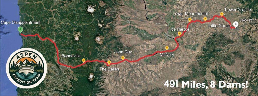
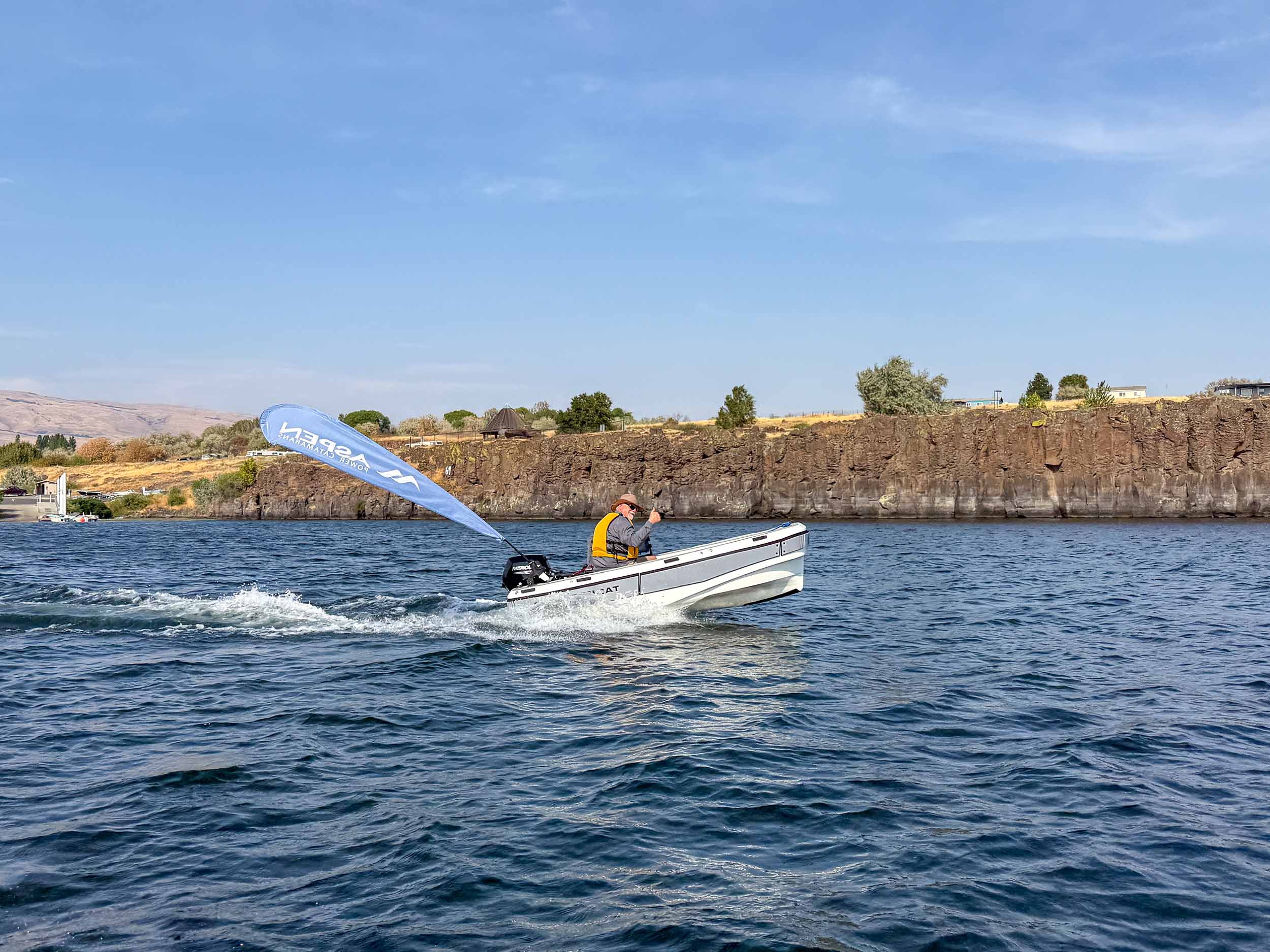
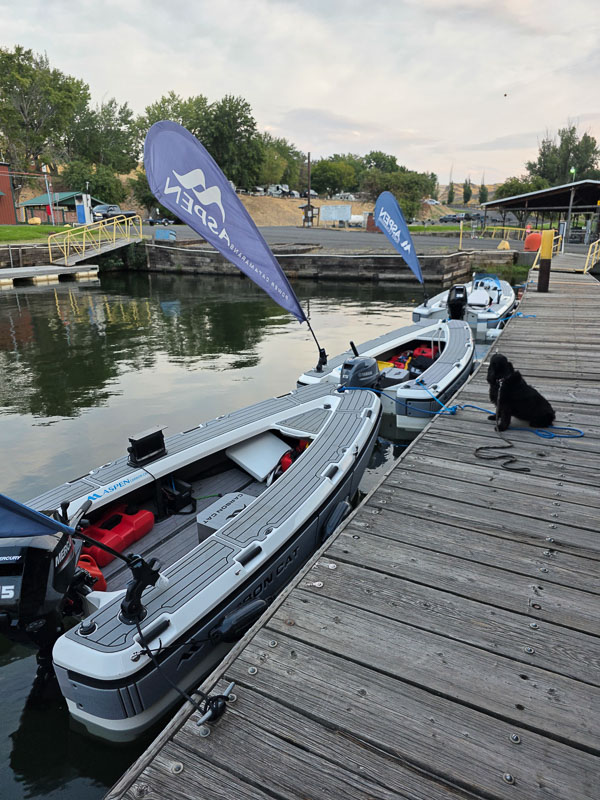
My latest adventure is a 491-mile trip up the Columbia River from the notorious bar known as the “Graveyard of the Pacific” all the way up into the Snake River. We start by running our Carbon Cat tenders on the river bar right where the United States Coast Guard (USCG) runs their surf training school teaching their operators to run their 47 Motor Lifeboats in the roughest possible conditions. From there we head up the Columbia and traverse 4 Dams/Locks to Pasco. After more river running, we go up the Snake River’s 4 Dams/Locks in our 3 little yacht tenders (10’, 11’, and 13 feet) This long trip traversing a mighty river in small boats fits the adventure-adrenalin bill to a TEE!
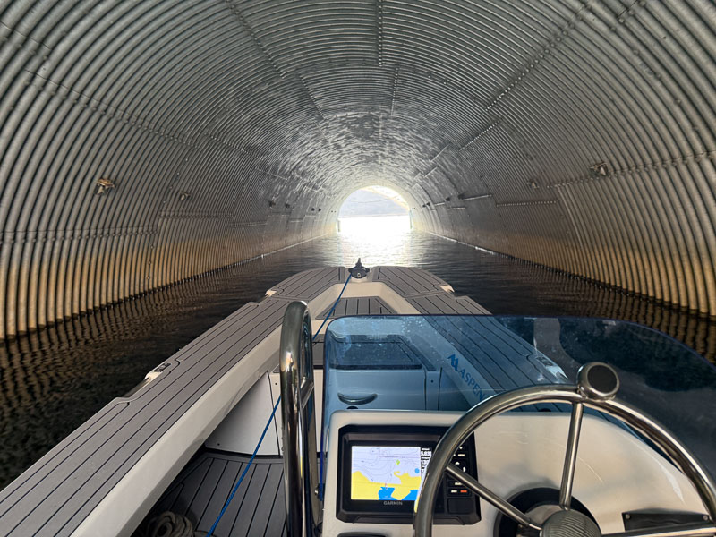
This is a trip others have done. But doing it in an open 10’ tiller handle 185-pound Carbon Fiber Tender is unusual. The experience when you are gliding along at 20 Mph with the warm wind in your face, sitting 36” above the water, no helmet, no windscreen, is simply refreshing. Long passages in a small vessel truly connect you to the boat and water in ways that are hard to achieve when operating a larger craft. The views are spectacular.
There were times on the trip when Mother Nature and the weatherman conspired against us with winds and rain. Still, adjusting our speed, tacking a bit… or just accepting that, yep, I’m going to get wet here… only made the smooth water, amazing mountains, and warm winds more delightful.

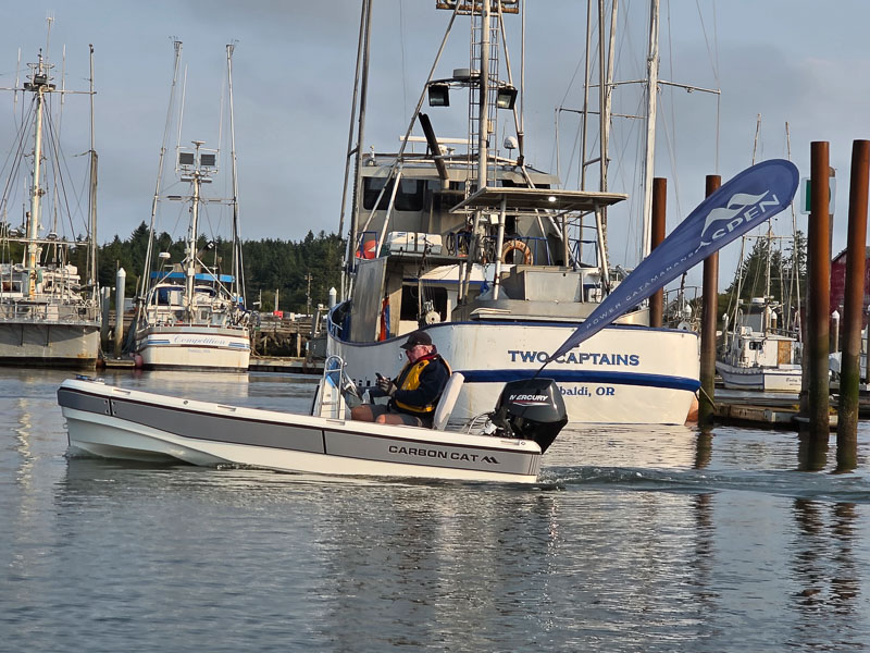
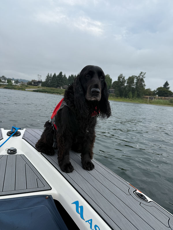
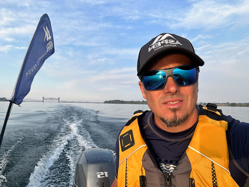
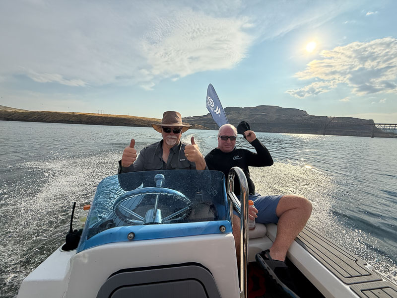
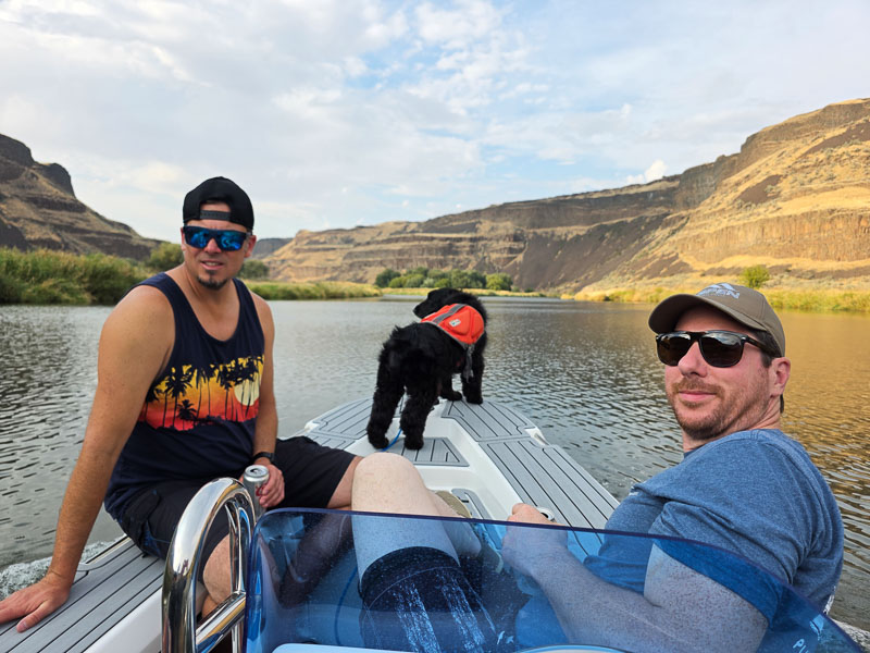
The participants in this adventure were my son Nick Graf, an outdoor adventurer (boats, motorcycles, and all water sports), as well as a Yacht Salesman par excellence. Len Renne, another very boaty outdoorsman, hunter, fisherman, and my former #1 Glacier Bay dealer from Fort Lauderdale. Daisy, my trusted dog companion, and our final adventurer Steven Gremmert, loves motorcycle adventures, hiking and all things mechanical. He’s also Aspen’s sales coordinator. This is a group that knows each other well and likes each other, always a key part of a fun, humorous trip.
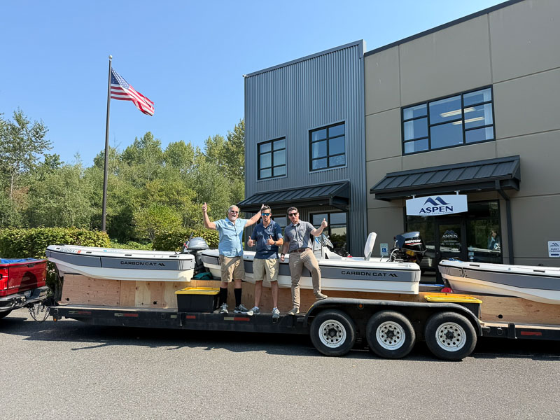
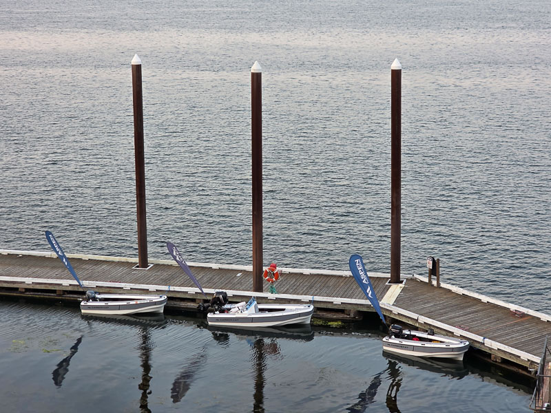
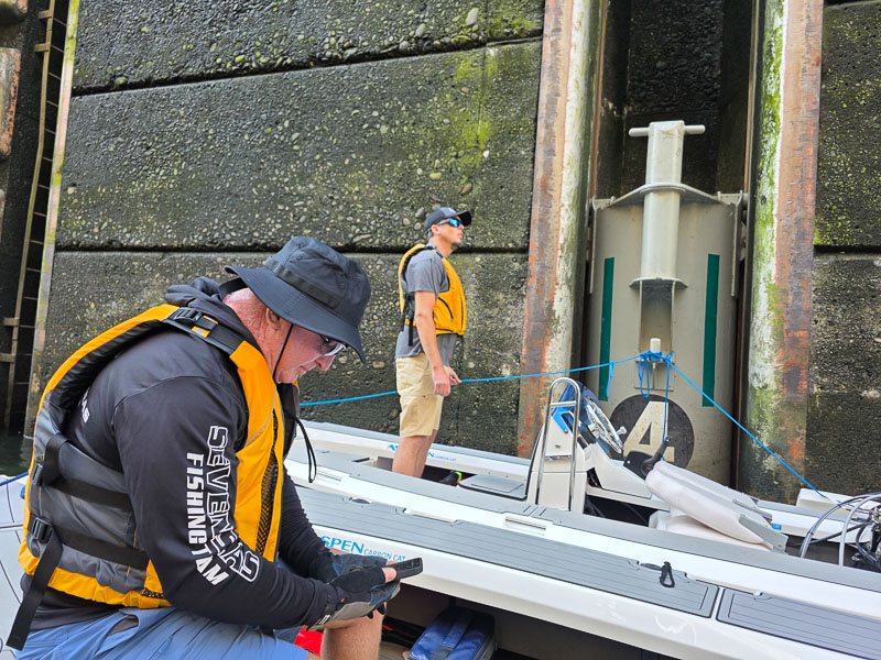
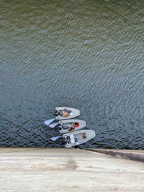
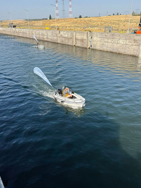
Our trip started in Burlington, WA, on September 6th. We’d spent the days prior to departure gathering equipment and supplies and building a special trailer that could carry all three tenders, making launching easy. We were unsure how the lock masters would view using such large locks (typically 86 ft x 675 ft) to transit such small boats. So, we organized the trip with three boats and a follow truck that we’d swap driving, so if needed, we were able to trailer around a lock and re-splash. Each lock/dam has launch ramps above and below, which gave us options. As it turned out, all the lock masters were happy locking our little triple boat package through, but some wanted us to wait up to 3 hours for other boats to gather.
Sitting twiddling our thumbs for 2-3 hours with this group of type-A personalities was not a good option. In the end, we used 2 of the 4 Columbia River locks and 3 of the 4 Snake River locks. By the 3rd and final time, trailing around a lock we had it down to a 20-minute process, each team member knowing his task well.
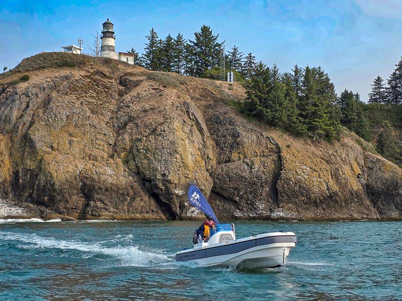
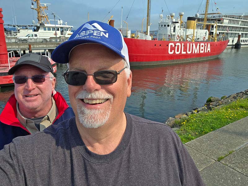
Our first day on the water started in Ilwaco, WA, on the North side of the Columbia. This little fishing harbor sits right next to the bay where Robert Gray entered the Columbia in 1792 and where John Jacob Astor’s first fur trading ship, the Tonquin, was very nearly lost on the rocks of Cape Disappointment in April of 1810. Later that year, the Tonquin was destroyed in a conflict with local Native Americans off the coast of Vancouver Island.

As we trolled out past the US Coast Guard station just inside the Bar, we were all thinking about the surf training school they run there to give their operators access to and experience in heavy seas. We had all seen videos of the USCG 47 Motor Lifeboats bashing through heavy seas and even rolling 360 degrees in breaking surf, right where we hoped to do a photo shoot in 10 minutes. Yep, full pucker factor.
This churned up area where the full force of the Columbia River meets ocean swells coming across the Pacific can be one of the most treacherous areas in the world. The full bar extends for miles into the ocean before the depths drop down thousands of feet into the Astoria canyon. We picked a great day to traverse this area in three small boats. As it turned out, even though we’d missed slack tide by 45 minutes, the swells were only 2-3 ft with a 1-2 ft chop as we entered the ocean and swung around toward Cape Disappointment light house. We made several passes for photos, and Nick even jumped in to cool off in his wetsuit. Len and I didn’t suit up, and Steven was our photographer that day.
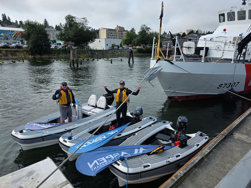
Then it was time to run 10 miles upriver to Astoria, Oregon founded by fur baron John Jacob Astor in 1811 as a fur trading settlement tying the vast fur territories up the Columbia to ports on the east coast. Astoria is the oldest permanent settlement west of the Rocky Mountains and is also home to one of the best maritime museums in the country that showcases the history of the Columbia River. We managed to sneak in for dock space under the bow of a BIG coast guard cutter with the friendliest crew you could ask for. If you ever get the chance to visit this museum, it is outstanding, and they are well into a major expansion that will make it even better.
This part of the river is unaffected by the first upriver dam 140 miles east. It’s wide (2-4 miles) near Astoria and shows little current. The main channel is dredged, but they have basins large enough to accommodate 10-15 ships while cargo is staged for shipment upriver. It is a busy river here, with ships moving upstream or downstream every 30-45 minutes. Our transit upriver was smooth and effortless; we passed a couple of hundred sport fishermen, a large dredge doing channel work, and sunbathers on soft sandy beaches. Our run into Portland’s Holiday Inn finished with a glowing orange sunset. With our photo shoot, we’d covered 120 miles, burning 6 gallons on the T10 and T11, and 7.5 gallons for the T13.
Day two started damp, with light rain falling as we packed fuel jugs down multiple stairs and a very long ramp to our dock. This portion of the Columbia is BIG and untamed by a dam. Fall storms and spring floods, combined with king tides, can raise river levels by 15 to 20 feet, so the docks have to accommodate this.
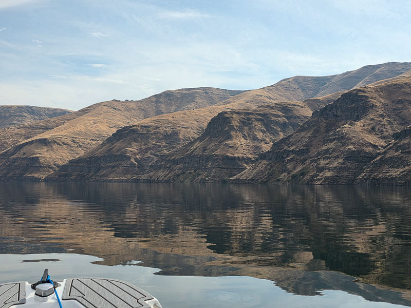
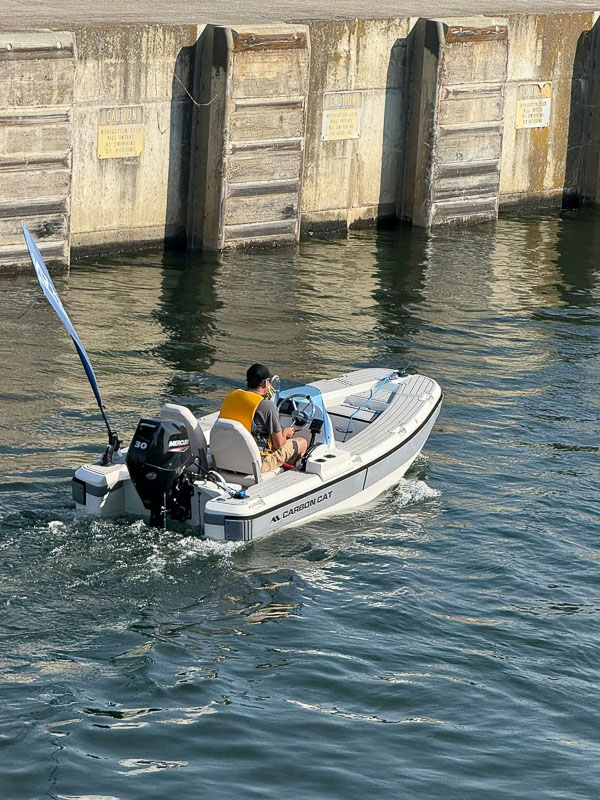
Our trip upriver was smooth and effortless. The homes and scenery were a delight. As we neared the mountains, the rain stopped, but the wind began to increase. As we passed Multnomah and Bridal Veil Falls and the Vista House Lookout at Crown Point, we were slicing through 1.5 to 2 ft chop in 15 to 20 Kt winds. Still fun, but we dropped our speeds to 14-16 to cushion the ride. Len in the T10 was the best at hunting for smooth water, zipping into coves and bays to grab some speed when possible. This was some of the first large chop the new T13 had been run in, and it was a delight for me to watch the bow cleanly split a wave and fold it outward and forward while I stayed dry and comfortable. The boys later nick-named the T13, “The Limo.” All Carbon Cat hulls are designed to run smoothly but the extra 2 feet of running surface and just a bit more beam of the T13 surprised us with its ability to easily break through chop without pounding.
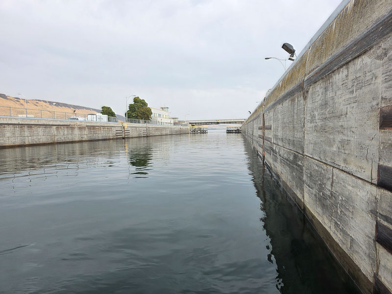

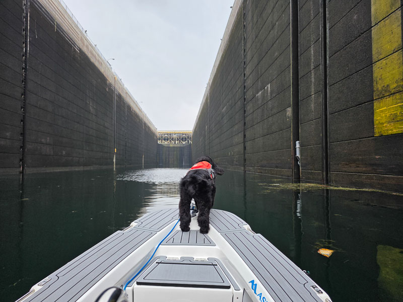
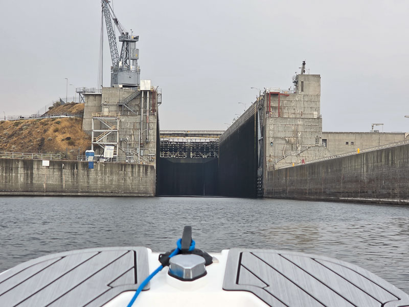
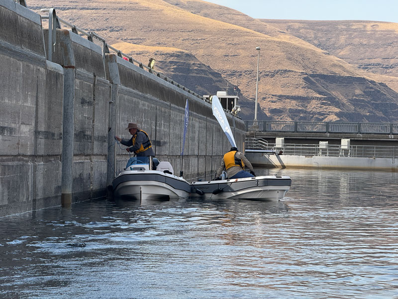
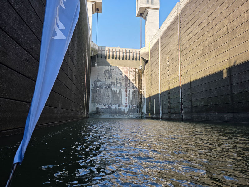
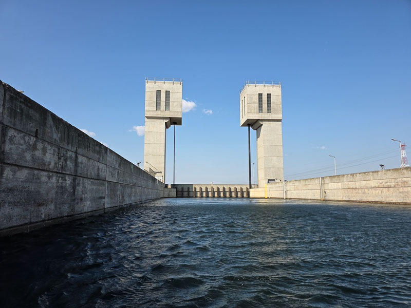
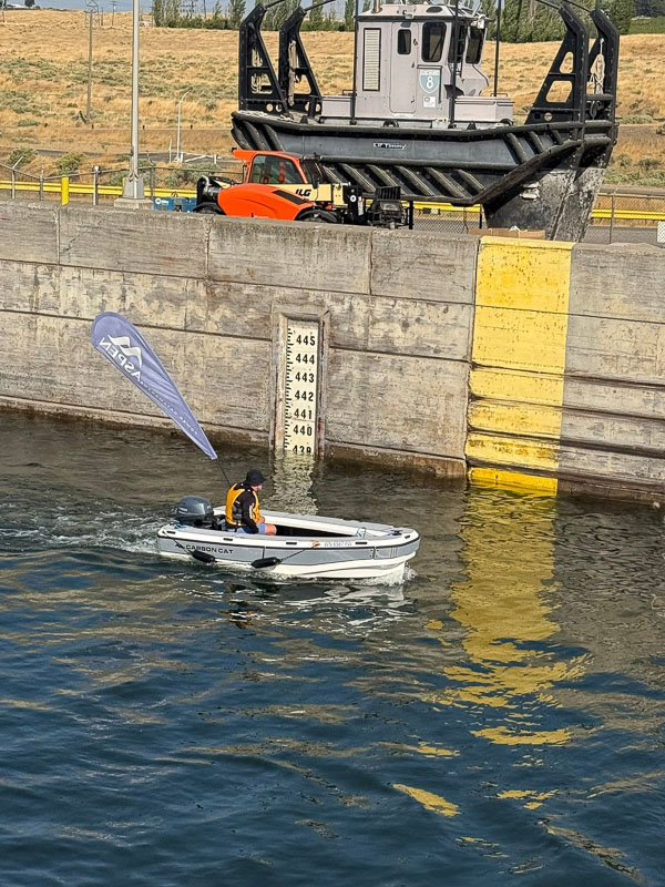
As we neared Bonneville Dam (built in 1934-37 which produces 5 billion kilowatt-hours of electricity per year, enough for 500,000 homes), the fishing boats were out in force, and many were catching Salmon. It’s always fun to see and hear the delight when someone hooks up with a big one. As we neared the dam finding the lock was not obvious; there were large signs that said, “Do Not Enter.” As you close in on the dam the lock is to the right and once spotted is JUST HUGE – intimidating from the perspective of a 10ft boat, for sure. Deep in the lock, we saw another pleasure boat, a 21 ft Boston Whaler that looked like an ant in a shoe box. We called the lock operator, who was very friendly and helpful, and he instructed us on how to proceed.
We slid the lock into place and tied the T13 to the floating bollard recessed into the lock wall. We then rafted the T11 and T10 on, called the single operator on the radio and let him know we were secure. The gates closed in just a couple of minutes, and the water began to boil a bit. Within 4 minutes, we were going UP at an amazing rate. This lock lifts 60-65 feet in just 8-10 minutes. With gates closing and opening, we were in and out in about 20 minutes. Just amazing, in comparison to the Ballard Locks in Seattle, 3-4 lock masters cycle the locks 12 feet in 30 to 50 minutes at the fastest. The water rises slowly – not so on the Columbia!
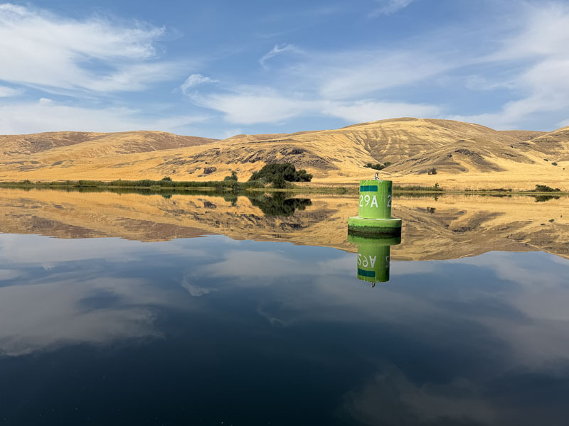
Lake Bonneville (48 miles long) above the Bonneville dam was a surprise; it’s a beautiful mountain lake set in the Columbia River Gorge. Its shores are a mix of wilderness and wonderful vacation homes. In many areas, we also saw native fishing platforms mounted to shore-side rocks cantilevered out over the lake, some wonderfully engineered, some not so much. The first section was glass smooth, and we stepped up the pace.
As the lake narrowed and the canyon walls grew during our approach to Hood River (Wind Surfing Capital of the World due to its consistent winds) the winds really started to step up. We had kite boarders and kite foil boarders zooming around us at speeds that looked like 30 + mph. Some were hopping huge jumps and floating above the water at speed. Needless to say, the chop in this section was running 2-3 feet. The Carbon Cats did very well, but we did get some spray. Len in the T10 even had some airtime as he tried to keep up with the Foil Boarders.
As we left Hood River, the gorge widened, and the scenery became much drier. Fewer trees, more burnt gold grass sloped on the mountains, beautiful. We were expecting the winds to die down as we moved farther east but some of the windiest sections of the trip that day were east of Hood River. I’d estimate we had steady 20 kts of wind with occasional gusts to 40 kts. The seas were running 3-4 feet. We came up on a very large Wheat barge tug combo coming at us. At a speed of 8-9Kts he was pushing a bow wave 6ft high with the chop stacking on top of that straight into these seas/winds. He had spray flying 600 feet aft of the barge all the way to the pusher tug. We slowed down for that wake.
As we neared Dalles, Oregon (Dalles Dam), the river narrowed, and we began to see Gill Nets tied to shore with nets and floats stretched out into the river with a large float on the end. I was surprised; I thought Gill Nets had been outlawed 30 years ago. They catch and kill every species of fish indiscriminately that doesn’t fit through the mesh size.
Closer to the Dalles Dam itself the winds died down, and the temperature rose to 102 degrees. We’re in eastern Oregon/Washington now! We arrived at the launch ramp/park, pulled the boats out, and headed to the Celilo Inn for dinner and a wonderful hotel room.
Day Three started with us splashing the boats above the Dalles Dam in Lake Celilo (24 miles long) for an early morning zoom up a calm lake. The lake sits in a canyon with basalt walls and cliffs formed by massive volcanic eruptions millions of years ago. Today, they make wonderful scenery. We raced a freight train and lost, then saw the Amtrak Empire Builder from Chicago zip smoothly by, headed for Portland. The folks on board seemed surprised to see us so early in the morning. This short lake also had 200+ Gill Nets again, how even one fish gets through, I have no idea.
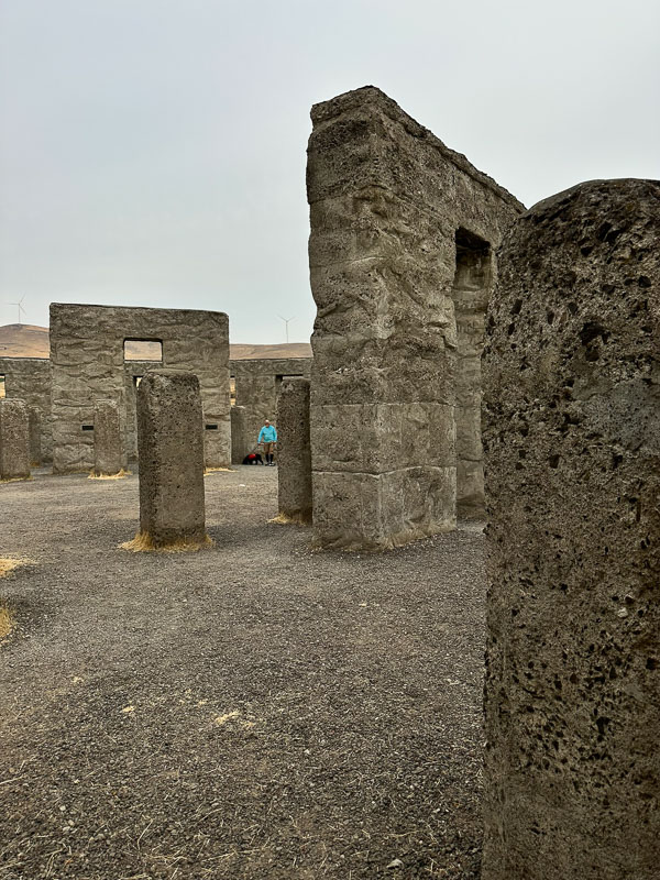
By 9:00 am, we were at John Day Dam, a 110-foot lift at the lock with 8.4 billion kilowatt hours annually, enough power to run 1.7 million homes. To speed our transit, we loaded the Carbon Cats on the trailer and made a quick stop at the Maryhill Stonehenge replica built by Samuel Hill as a memorial to World War 1 soldiers. We then re-splashed just upriver on Lake Umatilla (110 miles long) and headed for the McNary Locks/Dam.
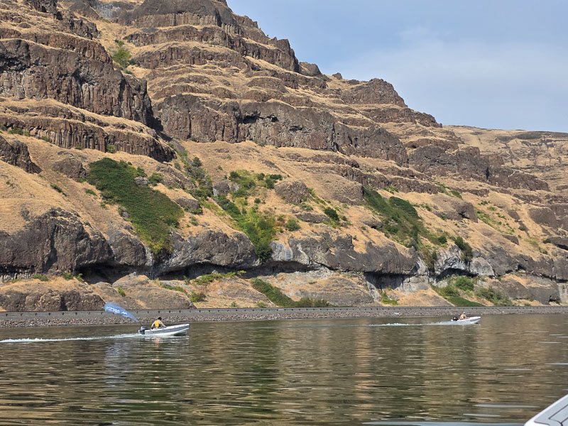
Lake Umatilla was silky smooth glass, so we made excellent time. The surrounding land was a mix of lower Basalt cliffs, mountains, and farmland, with grain terminals for the wheat harvest that included enormous round piles of wheat 80-100 feet high and 400 feet in diameter, wrapped in tarps and waiting for shipment. We continued to encounter pusher barge packs carrying thousands of bushels of grain toward ports near Portland. Lake Umatilla had the largest concentration of gill nets we saw on the trip. Typically, one every 500 feet for 60 plus miles. It’s interesting that the natives and certain “environmental groups” are pushing to remove the 4 dams on the Snake River while, at the same time, harvesting salmon so intensively along the Columbia. I should note that almost all these gill nets were placed in areas with no roads or public access other than by boat.


By 3:00 pm, we were already at McNary Lock/Dam, which provides power for 686,000 homes built in 1954. This dam was intimidating, with a 75 ft lift and dark grey storm clouds framing it. The lock master was again super friendly and impressed that we were doing this trip in such small boats. This 75-foot lift seemed like one of the fastest in the group on the Columbia. On the top side on the 64 miles long Lake Wallula, we ran over to the county park on the east side of the river and refueled for our run up to Pasco.
This run started just like Lake Umatilla, mirror smooth, but within 10 miles we had a ripple, then we had white caps with the wind straight on our nose. At its peak, we had steady 20 Kt winds with gusts to 40 or more. The wind even blew up a massive dust fog 100ft high over the river. It was a warm wind, though, and with some tacking and careful driving around the tallest waves, we maintained 10-14 mph. As often happens, it looked calmer on the other side, so Nick flew off in that direction, 3 miles, to check it out. The wind was the same, but he did find some shoreline shape that broke up the wave action somewhat.
The heavy winds slowly eased by 6:30 pm as we moved upriver. By the time we were in the canyon section about 15 miles from Pasco, they had dropped completely, leaving us with spectacular golden mountains, a glowing sunset, and dramatic Basalt cliffs to revel in. I had no idea this exceptionally scenic area even existed.
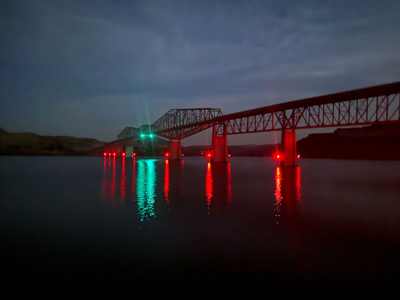
By 7:15, Pasco/Tri Cities and the Cable Bridge came into view and were a sight to see as we headed into the dock at the Wood Springs Suites. This was our longest day on the water. Across all three lakes, the team covered 189 miles, burning approximately 9.5 gallons in the smaller boats and 11.8 gallons in the T13 with its 30 HP engine.


On Day 4, we departed at 8:30, heading back downriver 3 miles to the Snake River entrance. After rounding the point at Sacajawea State Park, we entered the Snake for the final legs of the journey. Our weather was holding wonderfully, bright blue skies, temps in the 75-90 range, and relatively light winds. The Snake is narrower than the Columbia’s typical ¼ to 1½-mile width. Near Pasco, the Snake is typically 800 to 1000 feet wide, and just 8 miles upstream is the Ice Harbor Dam/Lock. It was built in 1962, and like all the dams we saw, it still looks brand new. The Bonneville power team keeps all its equipment A1 sharp. The US Army Corps of Engineers primarily owns the dams and is run by the US Bureau of Reclamation, though the Bonneville Power Administration markets them. The Ice Harbor lock was the first to feature a curved vertical lift wall rather than a swing gate on the downstream side. The lock has a 100-foot vertical lift, and it moves very FAST once the ends are closed. It also has a very smart upstream gate/wall that drops down, once the pool levels are equalized, just enough to cover the vessel’s draft. This means that it has a much faster cycle time with fewer movements on the immense doors and gates. Ice Harbor has the power to supply 750,000 to 800,000 typical homes. It’s interesting to note that the largest dam on the Tennessee River system (Wilson Dam in Florence, Alabama) only has the capacity to power 433,000 homes.

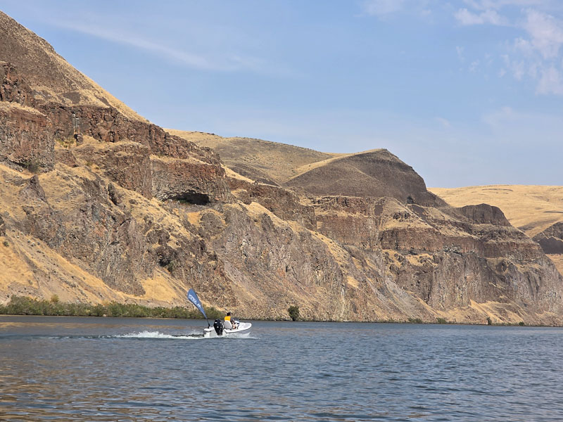
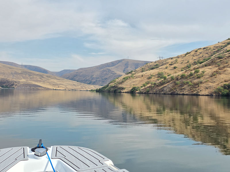
Lake Sacajawea (32 miles) is set in a basalt canyon and winds its way northeast, then east, then southeast. Every mile or two, it has a bend. It’s deep and much narrower than the Columbia. The Snake winds through the Palouse and Rolling mountains all the way to Lewiston.
By noon, we were at Lower Monumental Dam lock. This is another modern dam with curved lift end walls on the lock that, while silent, moved swiftly, dropping us in Herbert G. West Lake to the east. This dam also powers 750,000 homes. The lift is 100 feet. As an engineer I marvel at the power output of these dams. A key factor making this possible is the 100-foot drop lake to lake. Water is heavy (8lb’s per gallon) and the mountainous terrain supplies huge, stored energy.
The run up Lake Bryam (37 miles) brought us deep into the Snake River Canyon. The Basalt Cliffs grew to 800-1200 feet. Here we had silk-smooth water again, and it was hard to hold Len off the wide-open throttle pin.
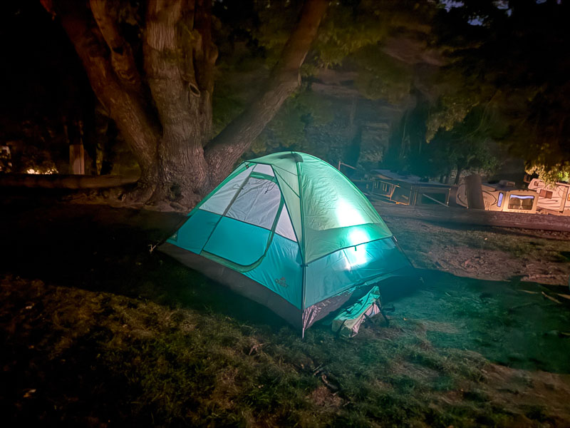
Our stop for the night was Lyons Ferry Landing/Palouse Falls Park. We found the State Parks camping area closed, but across the river was a great KOA with dinner options and a small marina. We set up camp, and it was time for a cold one. We’d covered 85 miles for the day. After dinner, we all loaded into the T13 and went up the inlet/creek toward Palouse Falls. After a rainstorm or spring melt, it’s dramatic. For our visit, the canyon was beautiful, but the falls were dry!
Day 5, we broke camp and were running upriver by 9:00 am. Len was rearing to go. Daisy’s snoring had kept me up. I was moving slowly. The next stop was Little Goose Dam, built in 1963; its output was similar to that of the other dams. Here, the lift/lock operator wanted us to wait 2 hours, so we trailered around and were back to zooming up the river in 40 minutes: blue skies, 80 degrees, and wonderful scenery on the lake.
With more silk-smooth water, the team arrived at our last dam, Lower Granite, by 11:30 am, ready for a 12:00 pm opening. As we loaded into the lock, the realization that we were going to “finish this crazy adventure…” A-OK, I’m sure, was on everyone’s minds, as well as a bit of remorse that it was almost over. Lower Granite Lake was 39 miles, then turn right at Lewiston-Clarkston, and done. Lower Granite Lake was again a deep, wonderful canyon with mirror waters. As we neared Lewiston, the sky darkened, the drips became drops, and drops became a torrential downpour, complete with booming lightning and wind. No time to reminisce. We loaded all three boats ASAP and dove into the truck.
3 little boats. 4 guys. 1 dog. 5 days. 491 miles.
I’d do it again in a minute.